Showing posts with label Views. Show all posts

Sunday, April 18, 2010

Aquereberry Point

A view of Badwater, the lowest point in the United States, from Aquereberry Point.

Pete Aguereberry, the miner that built the trail to this spectacular viewpoint, was apparently one of the very few good guys that populated Death Valley in it's early mining days. Late in his life Pete built the trail to this "Grand View" of Death Valley with a wheel barrow and his hand tools, so he could share the view.

This is Bill, having a look:


Badwater
Close up, sort of.

This is the bottom of Death Valley, so people like to walk out and see for themselves. 282 feet below sea level.


Rhyolite Ghost Town


The train depot at Rhyolite badly needs structural repairs. Administrators with the BLM need to develop a new visitor experience. The chain link fence with the razor wire on top that surrounds the entire building makes it look more like a crime scene than a historic treasure.

Friday, April 16, 2010

Blue Mountain from the iphone


This is the second picture I took with my new phone. The first one was of my lap.

Wednesday, November 11, 2009

Toiyabe Range


This is the eastern wall of the Toiyabe Range, looking SSW, as seen from Highway 50 about 12 miles east of Austin. On the map below the spot would be very near the intersection of U.S. Highway 50 and Nevada Route 376.


View Larger Map

Friday, October 23, 2009

Big Rocks


Chocolate Mountain, Santa Rosa Range, Humboldt County, Nevada
October 7, 2009


Hinkey Summit, Santa Rosa Range, Humboldt County, Nevada
October 10, 2009

Took these photos during three trips to the Santa Rosa Range. My friend Stuart invited me to help out with a photography field trip for his class at Great Basin College. We went out on "scout" trips twice to find a good location for a large group. Then we took about 18 people out to one location we'd found in the mountains, and then on the way back to town spent some time in Paradise.

This sounds like much more of a report, than a story....argh...


Try the full screen feature.

Monday, July 21, 2008

Landscape-Mindscape


White Mountains, in California, at a photography workshop.


It was a beautiful spot, among groves of Bristlecone Pines, some of the oldest living organisms on the planet.


Friday, June 27, 2008

Wishbone


There is this shot. It's a little late since it was taken in March I think. But I liked it. The last snow of the season. About three days later it was all gone. The trail will wrap around the back side of this ridge when it is constructed next spring. Those Humboldt's over in Pershing County, and the Humboldt River Valley show up nicely.

Friday, May 23, 2008

Which Way Did They Go ?

It must be a sign of the times.
end-of-scenic-route reminded me of this shot.


One thing you might want with you up on the mountain is a good set of body armor. A little thicker than this sign. A helmet might be a good idea as well.

Monday, April 28, 2008

Sun Down again

The view down the street this afternoon.


We've been having some strong wind storms. This afternoon, about sundown, the wind was taking the dust northeast. The wind blows huge amounts of soil, very fine dust mostly, into the air, and then carries it away in huge choking clouds.

The lands producing most of this dust are the vast acres burned by wildfire. The oceans of sage and clump grass having been burning away over these lands in what has become a annual ritual. The burned lands may never recover. There are now invasive species of grass weed that are propagating so quickly that the same lands can burn year after year. Mostly cheatgrass. There are a lot of different strategies, and tactics, much discussion, and some execution, on how to best address this problem.

I don't think there is a local solution. It appears to me that a different climate, one that provided more rain and snowfall, might be required. That may not come anytime soon.....

I wonder if 500 years from now this area will be the north reaches of the Mojave Desert?

Friday, April 25, 2008

Jungo Flats


This afternoon we made our way in the sedan, to the beach, but we couldn't ever find the water. We could always see it, just over there, but we couldn't ever sneak up on it.

This image reminds me of a vistor from the far east we saw in NYC, on the south tip of Manhattan Island. He had his cell phone mounted on a 5' tripod, and was taking a photo of the Statue of Liberty The photographer above is using her iPhone.

Wait till you see the video morsa made, you'll be amazed.


Thursday, July 19, 2007

What Is It?


So I'm trying a new contest, to see if anyone is listening out there. Do you know where this is? Take a guess, and leave it in the comments. Second question: What state is this?

.................

I found this in the papers the other day, and thought you photographers might find it interesting:

Liar, Liar, Pants on Fire

July 10, 2007,
By Errol Morris

From the New York Times Opinion Blog

Zoom - A Filmaker Under Covers the Hidden Truth of Photo's

Pictures are supposed to be worth a thousand words. But a picture unaccompanied by words may not mean anything at all. Do pictures provide evidence? And if so, evidence of what? And, of course, the underlying question: do they tell the truth?

I have beliefs about the photographs I see. Often – when they appear in books or newspapers – there are captions below them, or they are embedded in explanatory text. And even where there are no explicit captions on the page, there are captions in my mind. What I think I’m looking at. What I think the photograph is about......... more >

Thursday, July 05, 2007

High Desert Heat


I've got a rocket
in my pocket,
I cannot stop to play.
Away it goes !
I've burnt my toes.
It's Independence Day !

Yesterday, July 4th, it was 103 F in these parts. Today at 5:00 PM it was up to 105 F. Seemed like ideal conditions for a short expedition. My friend Mike went along for the trip. Surprised me a bit, cause it was a real spontaneous plan.

These shots are taken from Winnemucca Mountain. It was very quiet up there today. We never made it to the top, but stopped off along the western flank, about half way up.

The vehicle in the image above is coming in from the Black Rock Desert, on Jungo Road. You can see the effects of a recent fire in the middle of the photo.


The Jackson Mountains this evening.

Tuesday, July 03, 2007

Hungry?


If you get that feeling in your stomach, and make a drive up for a number 2, you might see this. Blue Mountain. Taken from the drive-through at Burger King.

Been absent for some time, but there is news. JA is blogging! Check out the first post at Mind-Over-Matters. Be the second visitor to view his extensive profile. I just added it to the neighborhood. Wheeeeee Isn't this fun!

Monday, March 19, 2007

Spring Again


It seems like we just did this last year. The wheels keep on turning.

Inspired by the great photos I saw this weekend at Shooting the West, I went up the slope of the Sonoma Range and took this picture across the Humboldt Valley. Winnemucca Mountain just after sun up.

Friday, February 02, 2007

Town of Humboldt, Nevada

It's that time of the year, when the landscape is washed over by the late winter sun.

I had occasion to drive over to the Biggest Little City after work yesterday and stopped off at Humboldt to watch as the sun went down.


The town of Humboldt lies just off the north tip of the Humboldt Mountain Range in Pershing County.

Humboldt used to be in Humboldt County until someone accidentally burned down the courthouse in Winnemucca.

When the folks over in Lovelock got a glimpse of the plans for the new courthouse, with its columns and marble staircases, they didn't believe they wanted to help pay for such an expensive building over in the county seat, so they seceded, and formed their own county. Then they built their own special courthouse. Folks around here don't seem to have got over that little spat yet.


When the boundary was set to cleave Humboldt County into two parts, the town of Humboldt, a service stop on the transcontinental railroad, found itself in the new Pershing County. Named for WWI hero General of the Armies "John Joseph "Black Jack" Pershing.


This the the entire town. I saw two satellite dishes, so they are probably inside watching FOX News.


Molten sun on a chilly afternoon.


Friday, January 26, 2007

East Ely Rail Shed


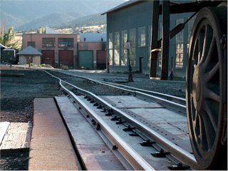
One of the sheds in the Nevada Northern Railway yards at Ely.

It's number 5 on this map.

There are some more of my images from down that way right here.

Monday, January 01, 2007

New Year's Day on the Flats


Took a little trip out west this afternoon, to the Jungo Flats, about 35 miles west of town. It was a nice quiet place to spend a bit of the first day of the new year. No people, no birds, no insects, no animals, no sound, no wind, just beautiful space and light. This playa is large enough that you can see the curvature of the earth if you look closely. Its a good place to think about the great wheels at work in the universe.


I did find this shadow lurking about, watching me over its shoulder.

Sunday, August 20, 2006

East Ely Rail Yards


On a recent road trip to Ely I spent a while in the rail yards of the Northern Nevada Railroad. Reminded me of the hours I spent in the rail yards in my home town on the high plains. Living only two blocks from the roundhouse and switching yard provided a great opportunity to a 12 year old kid. We'd go there at night, or on a Sunday afternoon, and climb on and through the railcars and equipment, always on the lookout for the railroad detectives that were known to show no mercy to children.

Interesting picture. Try to find the focal point.

Monday, October 24, 2005

Road Trip


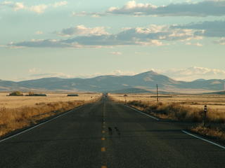
Ely. My fall trip. Ten hours of driving for a four hour meeting.


Austin, Eureka, Ely; its like driving into the past. The places all look like they had their best days many years ago. It's interesting how much they all feel like towns I remember from childhood trips to the Applachian Mountains. Mining towns.


Lots of churches, but almost all of them seem deserted. This one is about half pink.

Saturday, August 20, 2005

Cross-country cyclists find new threat in White Pine County

Friday, Aug 12, 2005

A group of bicyclists traveling from Philadelphia to San Francisco to raise money and awareness for cancer research had an adventure after leaving Ely and before arriving in Eureka.

When available the riders have been posting messages on a travel journal on the website www.pennride.org.

The big Nevada highlight came on the ride from Ely to Eureka. Halfway up our last climb of the day, Tim was... parents, stop reading here... [Joe now writing] chased for about 4 or 5 minutes uphill by a mountain lion. I was at the top of the hill, and Tim arrived, panting like crazy, and looking kind of wild. It turned out that he had seen a lion cross about 100 metres (this isn't Tim writing, I swear) in front of him, and then, when he passed it, it gave chase and ran after him up the hill for around a mile. I knew he was serious when he met me at the top saying, "Joe, do you have cell service? We have a legitamite [sic] emergency." We flagged down two cars to warn the others still en route of the danger. Luckily everyone made it into town safely, and we have a lovely stay in the county fair grounds. [Joe done writing]Parents, you can start reading again.